Interstate 94
Overview
Interstate 94 is a lengthy route connecting the High Plains, Upper Midwest and Great Lakes regions. It originates in Billings, Montana splitting with Interstate 90 and following the Yellowstone River northeast to Glendive before curving eastward to Wibaux and Beach, North Dakota. The freeway crosses the width of North Dakota, traversing the hills of Little Missouri National Grassland to the wide open plains from Dickinson east to Bismark and Fargo.
Fargo is the largest city in North Dakota, and I-94 expands to six lanes as it passes south of Downtown. The freeway crosses the Red River into Morehead, Minnesota where it turns southeast toward Fergus Falls, St. Cloud and ultimately the Twin Cities. Once at Maple Grove, a suburb of Minneapolis, I-94 splits with Interstate 494, the southwest beltway of the Twin Cities, for an increasingly busy route east to I-694 and south into Minneapolis. As I-94 encircles Downtown Minneapolis, the freeway utilizes a cut and cover tunnel both just south of I-394 and west of the 90 degree turn toward Interstate 35W. A brief side by side route occurs with I-35W ahead of their respective crossings of the Mississippi River.
Continuing east from Minneapolis, Interstate 94 heads toward Downtown St. Paul and the confluence with Interstate 35E and split of U.S. 52 south. The freeway leaves the urban area via Maplewood and Oakdale to cross the St. Croix River into Wisconsin. Much of the drive through western areas of America’s Dairyland is rural, as I-94 turns southward again at Eau Claire to combine with I-90 at Tomah and I-39 at Portage. The three routes combine 29 miles southward to Madison.
I-94 turns east from the Wisconsin capital city en route to Milwaukee and then south by Racine and Kenosha to northern Illinois. I-94 combines with Interstate 43 from I-794 at the Marquette Interchange in Downtown Milwaukee to the Airport Interchange with south end of I-894, the Milwaukee bypass. Interstate 41 overlaps with I-94 south from I-894 to Exit 1 at Rosecrans, Illinois.
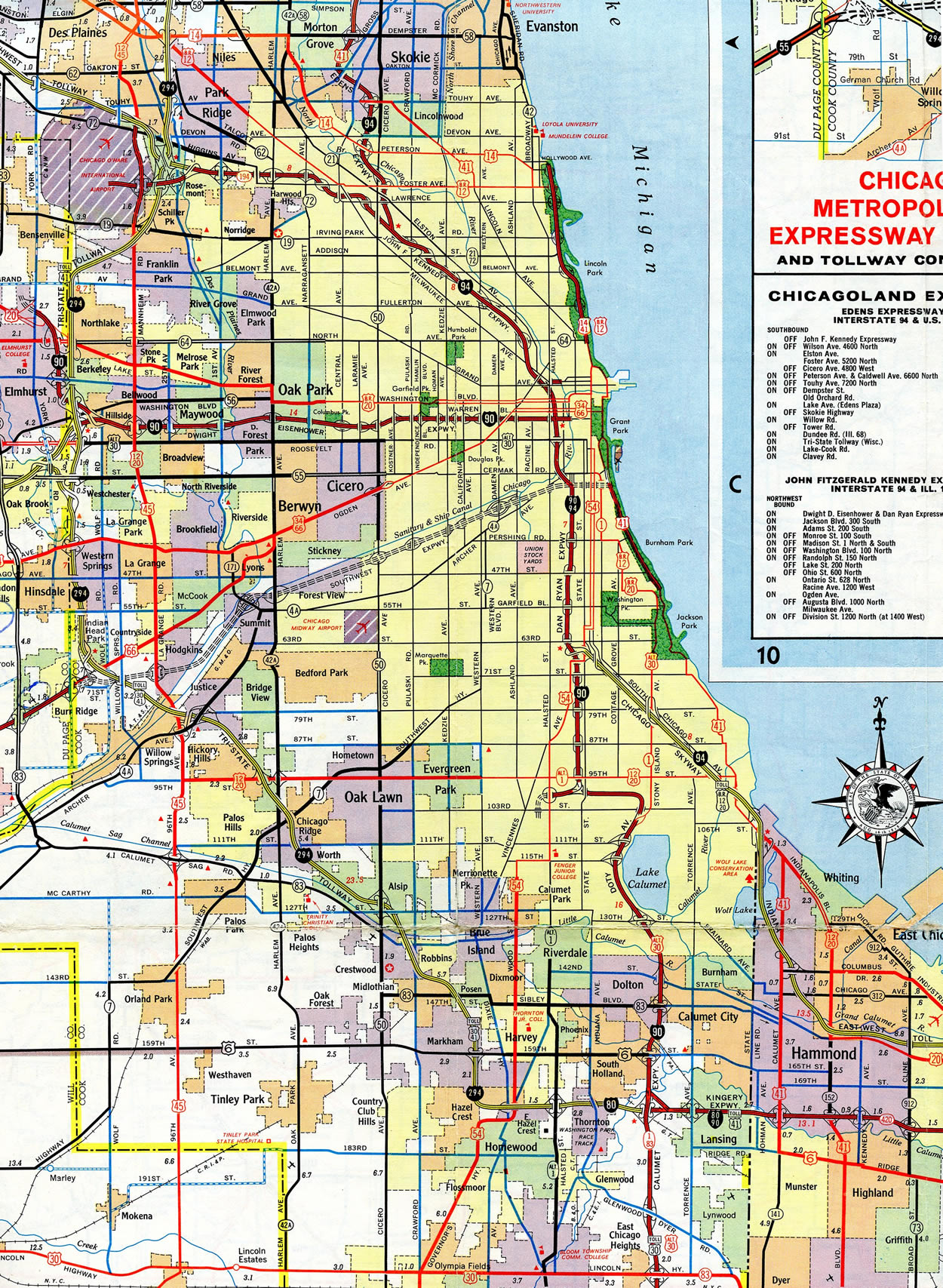
Through the Chicago area, Interstate 94 follows the Tri-State Tollway south to both I-294 and the Edens Spur. The tolled spur links the Tri-State Tollway with the Edens Expressway, which Interstate 94 takes south to the overlap with I-90 along the Kennedy Expressway. The Kennedy carries both to the Chicago Loop, where the Dan Ryan Expressway and Eisenhower Expressway (I-290) come together. The 15.39 mile long overlap along I-90/94 concludes at the Dan Ryan interchange with the Chicago Skyway in south Chicago. I-90 angles southeast on the toll road to Calumet City, Indiana, while I-94 remains southward along the Dan Ryan to I-57 and the Bishop Ford Freeway.
Following the Bishop Ford Freeway, Interstate 94 heads south to South Holland and Lansing, where the route resumes an eastward course alongside I-80 on the Kingery and Frank Borman Expressways through northwest Indiana. The 18.53 mile long overlap with I-80 ends at Lake Station where Interstate 80 departs for I-90 east along the Indiana Toll Road toward Toledo, Ohio and I-94 shifts northward along the periphery of Lake Michigan to Michigan City and Benton Harbor, Michigan.
The 275 mile long route in Michigan turns Interstate 94 east at the split with I-196 for Kalamazoo, Battle Creek, Jackson and Ann Arbor. The freeway shifts southward leading toward Detroit, passing by Detroit Metropolitan Wayne County Airport (DTW) at Romulus along the Detroit Industrial Freeway. Joining the Edsel Ford Freeway at Dearborn, Interstate 94 angles northeast through Detroit to the Grosse Pointe cities and a northern turn to Macomb County. A rural stretch takes I-94 northward from New Baltimore off Anchor Bay to Port Huron and the overlap with Interstate 69. I-69/94 combine for 3.7 miles to the international boundary along the Bluewater Bridge east to Sarnia, Ontario.
High Priority Corridor
Interstate 94 from Chicago to Port Huron is part of High Priority Corridor 18: NAFTA Superhighway.
 Parallel U.S. Routes
Interstate 94 replaced U.S. 10 from Billings east to Fargo and U.S. 52 (former U.S. 10S) between Fargo and Minneapolis. From Minneapolis southeast to Madison, Wisconsin, I-94 follows U.S. 12, and it replaced U.S. 16 from there east to Milwaukee. At Milwaukee, Interstate 94 turns south to merge with or parallel U.S. 41. Once in Indiana and continuing east, it parallels U.S. 6 and U.S. 12-20. Northeast of Indiana, when I-94 enters Michigan, the freeway replaced the original alignment of U.S. 12. (U.S. 12 was rerouted onto former U.S. 112.) U.S. 12 ends in Detroit, and Interstate 94 replaced U.S. 25 from there northeast to its former end point at Port Huron, Michigan.
Major Projects
Wisconsin
A $810 million project between Spring 2005 and December 31, 2008 improved the Marquette Interchange, where I-43, I-94, I-794 converge in Milwaukee. Originally constructed between 1964 and 1968 and opened in December 1968 for a cost of $33 million, traffic counts at the Marquette Interchange eventually increased to over 300,000 vehicles per day, more than double what was intended.2 Road work redesigned the exchange to utilize entrance/exit points only from the right side of the freeway, have longer merge lanes, and reduce impact to neighboring communities.
Illinois
Between 2004 and 2007, the Dan Ryan Expressway section of I-90/94 was upgraded. Over 300,000 vehicles used the Dan Ryan Expressway daily, and these improvements were designed to enhance mobility, including:5
- Repave the expressway, including certain access roads between 13th Street and Interstate 57
- Eliminate exits to 43rd Street, 51st Street, 59th Street and 76th Street
- Add additional local lane on expressway (no additional express lanes)
- Add new transition ramp from westbound I-90/Chicago Skyway to northbound I-90/94
- Relocate the transition ramp from southbound Dan Ryan Expressway to eastbound I-90/Chicago Skyway
- Install collector sewers to avert flooding during heavy rainstorms
Work was formally completed, though landscaping and side work continued into 2008, on the Dan Ryan Expressway project after a ribbon cutting ceremony held on October 25, 2007 at the 39th Street entrance ramp to the outbound Dan Ryan. The two year project rebuilt the freeway mainline with 14 inches of continuous steel reinforced concrete. It added an additional travel lane in each direction, lengthened on and off-ramps, improved drainage, added high mast lighting, incorporated aesthetic improvements, and redesigned and rebuilt the interchange with the Chicago Skyway. 28 east to west bridges over the Dan Ryan were also rebuilt.6
A similar project was underway with the reconstruction of the Kingery Expressway in Illinois and the Borman Expressway in Indiana. For the Kingery Expressway (I-80/94 and U.S. 6), construction ran from January 2005 to July 2007. Improvements included:7
- Revision and reconstruction of the interchange joining I-80, I-94, I-294 and IL 394
- Expansion to eight through lanes for through traffic on Interstate 80
- Reduction of weaving through reconfigured interchanges
- Installation of sound walls, replacement lighting, and landscaping
Indiana
In Indiana, the Frank Borman Expressway carries I-80/94 and U.S. 6 through Hammond and Gary. As part of the “Major Moves” state wide funding, a $300 million project upgraded the freeway from the state line east to Interstate 65 between 2004 and Summer 2011. Work added lanes in both directions, reconfigured several interchanges and rebuilt the junction with I-65 with a new flyover from westbound to southbound.8
Michigan
Two projects in Port Huron focused on redesigning the overlap between I-69/94. The first project widened 2.2 miles of the freeway between Lapeer Road and Pine Grove Avenue. This $90 million project included bridge replacement of the spans over the Black River, which separates local traffic from traffic headed to the Bluewater Bridge into Canada. Construction started in March 2011 and was completed on October 19, 2012.4
The second project, totaling $76 million in costs, commenced in Fall 2013. Work here focused on rebuilding and redesigning the west split interchange between I-69/94, where Business Loop I-69/94 ties in from the southeast. Construction effected 3.7 miles of freeway and replaced several bridges and ramps. Work ran through Fall 2015.15
Route Information
Montana – 219.38
Cities – Billings, Miles City, Glendive
- Junctions –

North Dakota – 352.39
Cities – Dickinson, Mandan, Bismarck, Jamestown, Valley City, Fargo
Junctions –

Minnesota – 259.49*
Cities – Moorhead, Fergus Falls, Alexandria, St. Cloud, Minneapolis, St. Paul
Junctions –
Wisconsin – 341.02**
Cities – Eau Claire, Tomah, Madison, Waukesha, Milwaukee, Racine, Kenosha
Junctions –
Illinois – 61.53***
Cities – Waukegan, Highland Park, Skokie, Chicago, Calumet City
Junctions –
Indiana – 46.13#
Cities – Hammond, Gary, Portage, Michigan City
Junctions –
Michigan – 275.49
Cities – Benton Harbor, Kalamazoo, Battle Creek, Marshall, Jackson, Ann Arbor, Ypsilanti, Dearborn, Detroit, Port Huron
Junctions –
Source: December 31, 2021 Interstate Route Log and Finders List
* – 0.27 miles on I-35E
** – 91.76 miles on I-90, 25.50 miles on I-41
*** – 2.48 miles on I-80, 2.50 miles on I-41, 15.39 miles on I-90
# – 16.05 miles on I-80
I-94 Annual Average Daily Traffic (AADT)
| Location | Vehicles per day |
|---|---|
| Gary, IN | 191,251 |
| Michiana Shores, IN | 18,796 |
Source: 2019 AADT INDOT Traffic County Database System (TCDS)
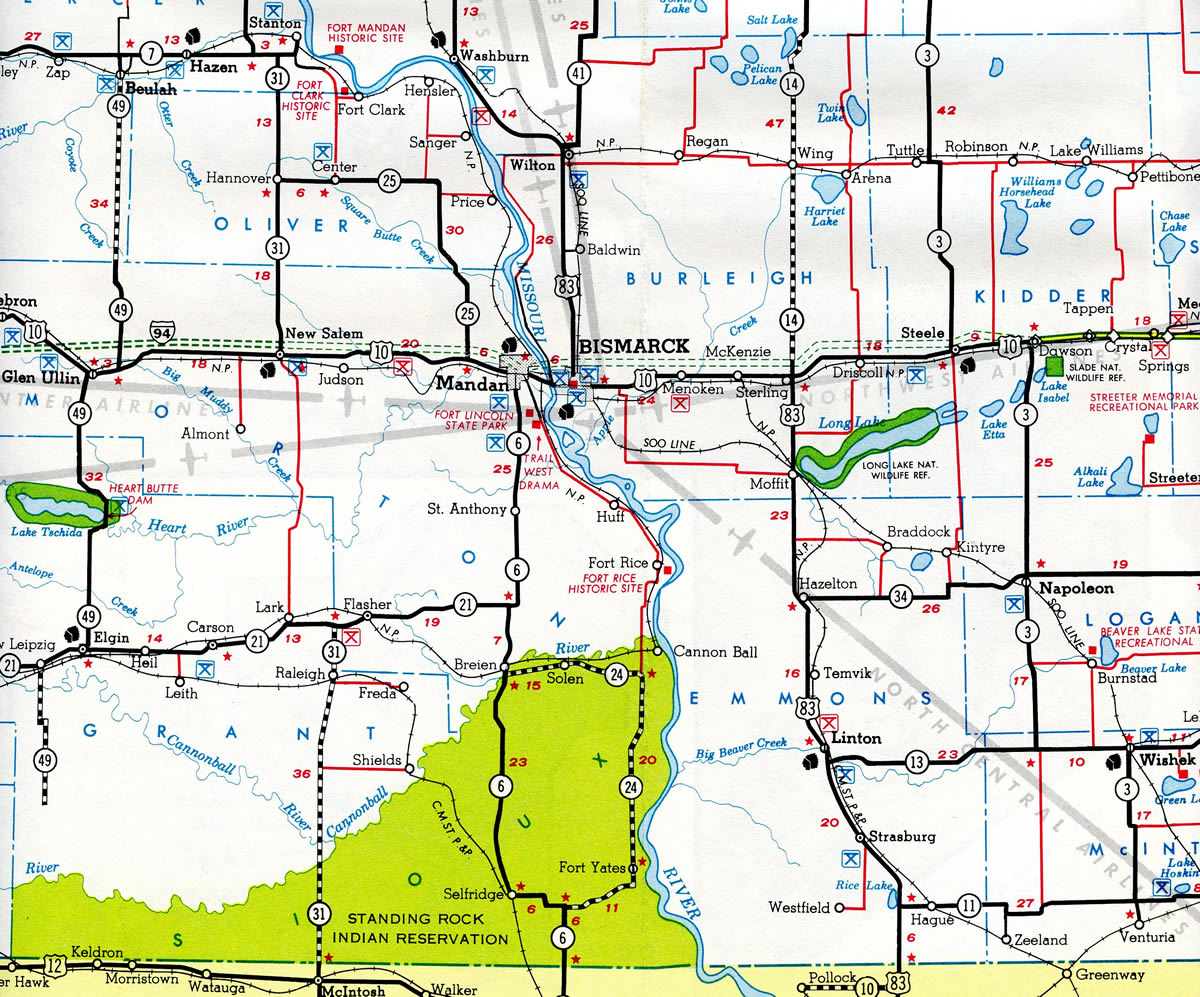
Interstate 94 was open from North Dakota 3 at Dawson eastward to the Minnesota state line by 1963. The Bismark to Dawson section, completed in 1975, was the last to open in the state.16
Until 1963, the alignments of Interstates 90 and 94 were switched from south Chicago to northwest Indiana. I-94 used the Chicago Skyway and Indiana East-West Toll Road, while I-90 remained along the Dan Ryan and Calumet Expressways south to the Kingery and Borman Expressways. This included an extension of Interstate 294 east into Indiana to meet with I-94 at Lake Station.
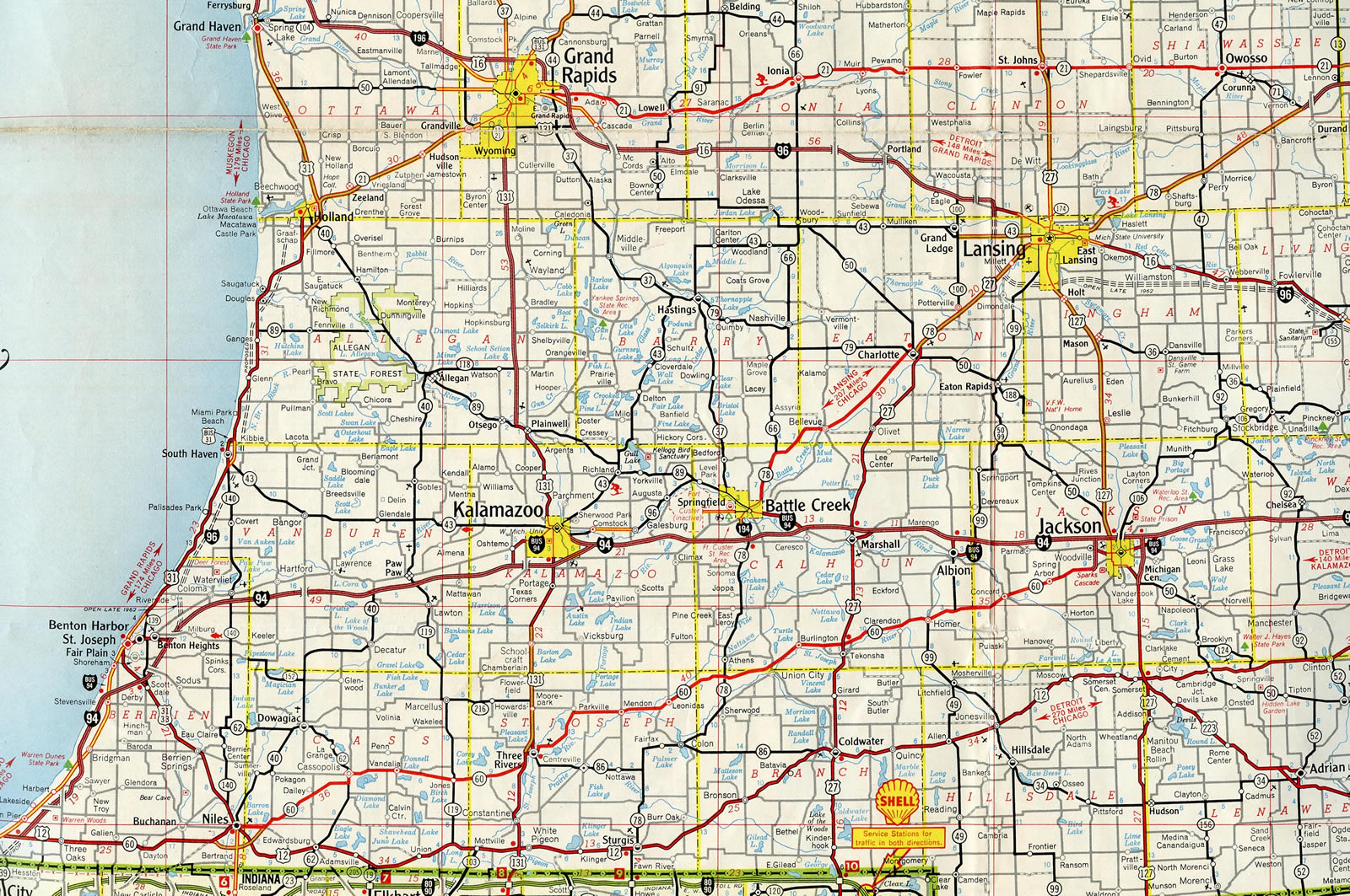
The bulk of Interstate 94 was completed across southern Michigan by 1962. The exception was the segment south from U.S. 12 to the Indiana state line. A three mile portion of this opened near New Buffalo to a point just north of the state line in 1963. The connection into Indiana came much later in 1972. 17
History
Montana
Contracts awarded by the Montana Highway Commission in April 1961 included work on a 11.5 mile long section of I-94 between Miles City and U.S. 10 east of Tusler. This stretch was completed in 1963.19 The final two lane section of freeway along Interstate 94 in Montana was four laned in 1985.20
North Dakota
The first section of Interstate 94 to open in North Dakota was the 39 mile long portion between Jamestown and Valley City. This section was chosen due to the poor condition of U.S. 10. Bids for the segment were let on December 17, 1956,22 and the new highway opened on October 16, 1958. The North Dakota Highway Users Conference sponsored a dedication ceremony for a 150 mile plus stretch of I-94, between Dawson and the Minnesota state line, on October 19-20, 1961. Following Michigan, completion of the North Dakota section made it the second longest continuous mileage on the Interstate highway system at the time.24
Another major section of Interstate 94 from Fryburg (near Theodore Roosevelt National Park) east to ND 25 in Mandan was dedicated and opened to traffic on October 6, 1964.9,10
Construction on I-94 from Mandan east to Bismarck followed, with a 15.3 mile portion opened east from ND 25 (Exit 147) following a December 9, 1965 ribbon cutting ceremony held at the Sunset Drive interchange (Exit 152). 271.7 miles of I-94 across the state were complete then, leaving segments between Dawson and Bismarck and Medora west to Montana unfinished.23
#Throwback time. Love this shot of I-94. Who’s road tripping this summer? #nddot
Posted by North Dakota Department of Transportation on Thursday, July 2, 2015
Interstate 94 displaced the old alignment of U.S. 10 east from Medora to a point just west of milepost 30. The remainder of U.S. 10 parallel to I-94 to Painted Canyon was demolished. The Painted Canyon Visitor Center off Exit 32 was located along the former US highway. Old U.S. 10 remains accessible along 36th Street SW south of Exit 36.
The 22.5 mile long segment from Medora west to the Montana state line was originally planned with just two lanes. North Dakota officials and the Bureau of Public Roads officials intervened, leading to an announcement made on May 7, 1964 that the road would be built with four lanes. Work started on this section in 1966.21 Completion of I-94 in North Dakota took place at a dedication ceremony held in Bismarck on August 7, 1970. Nationwide, Interstate 94 was 84% complete at that time, with the Peace Garden State representing the longest continuous stretch open to traffic.22
Minnesota
Within the city of Minneapolis, Minnesota, Interstate 94 passes through the Lowry Park Tunnel, a 1,492 foot long cut and cover tunnel opened in 1972.18
Wisconsin
According to Scott Oglesby’s Kurumi.com website, there were plans in 2003 to renumber the Interstates in and around Milwaukee to decrease traffic impact in Downtown Milwaukee at the Marquette Interchange. Under a proposal recommended by Mayor John Norquist, Interstate 894 would be eliminated, and the entire route would be renumbered as I-94. The section of I-43/94 would become solely I-43, and the section of I-94 between I-894 west of Downtown and I-794 would become part of a much longer Interstate 794.1 Mayor Norquist was responsible for the removal of the remnant of the Park East Freeway, which was demolished and reclaimed in stages between 2002 and 2004. This renumbering proposal may have ended around the same time that Mayor Norquist resigned from his post in 2003 to head the Congress for New Urbanism. Mayor Norquist’s successor, Tom Barrett, did not advance the proposal of his predecessor.
Illinois
Within the Land of Lincoln, Interstate 94 was built in stages during the 1950s and 1960s. The section of Tri-State Tollway from the Wisconsin State Line south to the Edens Expressway (including the Edens Spur) was constructed between 1956 and 1958. The construction of the 83 mile long section of the Tri-State Tollway (and the other original tollways) was funded by a bond issuance in the amount of $415 million by the state tollway commission (which was created in 1953).14 Continuing south from the vicinity of Skokie, the Edens Expressway opened to traffic in 1951, and it was one of the first urban freeways to open in metropolitan Chicago.11
The Kennedy Expressway, which connects Eisenhower Expressway (I-290) with O’Hare International Airport (ORD), opened to traffic on November 5, 1960. This 16 mile long freeway was constructed at a cost of $237 million. It was originally named Northwest Expressway, but was renamed to John F. Kennedy Expressway on November 29, 1963.12
The Dan Ryan Expressway, which continues I-90/94 south from I-290 (Eisenhower Expressway) to Interstate 57, opened on December 15, 1962. The freeway opened in conjunction with the Calumet Expressway (later renamed as the Bishop Ford Freeway) south to 130th Street / Exit 68 at a cost of $209 million. This freeway, planned as the “South Expressway,” was named in memory of Dan Ryan, who was the president of the Cook County Board of Commissioners and had died in 1961. Dan Ryan played a role in planning highway construction efforts throughout the 1950s and 60s in Chicago. He also proposed a superhighway in 1939 that eventually became the Kennedy Expressway (I-90/94)6,11 The Dan Ryan Rapid Transit line follows the median of the Dan Ryan Expressway; the rail line opened to commuters on September 28, 1969.13
The Bishop Ford (Calumet) Expressway offers the continuation of eastbound (outbound) Interstate 94 from the I-57 split to the Kingery Expressway; it was one of the first express routes to be built in Chicagoland, opening in the early 1950s around the same time as the Edens Expressway. The Kingery Expressway section of I-80/94 and U.S. 6 is one of the oldest sections of I-94 in Illinois, having opened in 1950.11 This is also the only section of Interstate 94 that truly travels east to west in Illinois.
 Photo Guides
East End – Canadian International Border – Port Huron, Michigan
![]()
![]() East at
East at ![]() / Bluewater Bridge
/ Bluewater Bridge
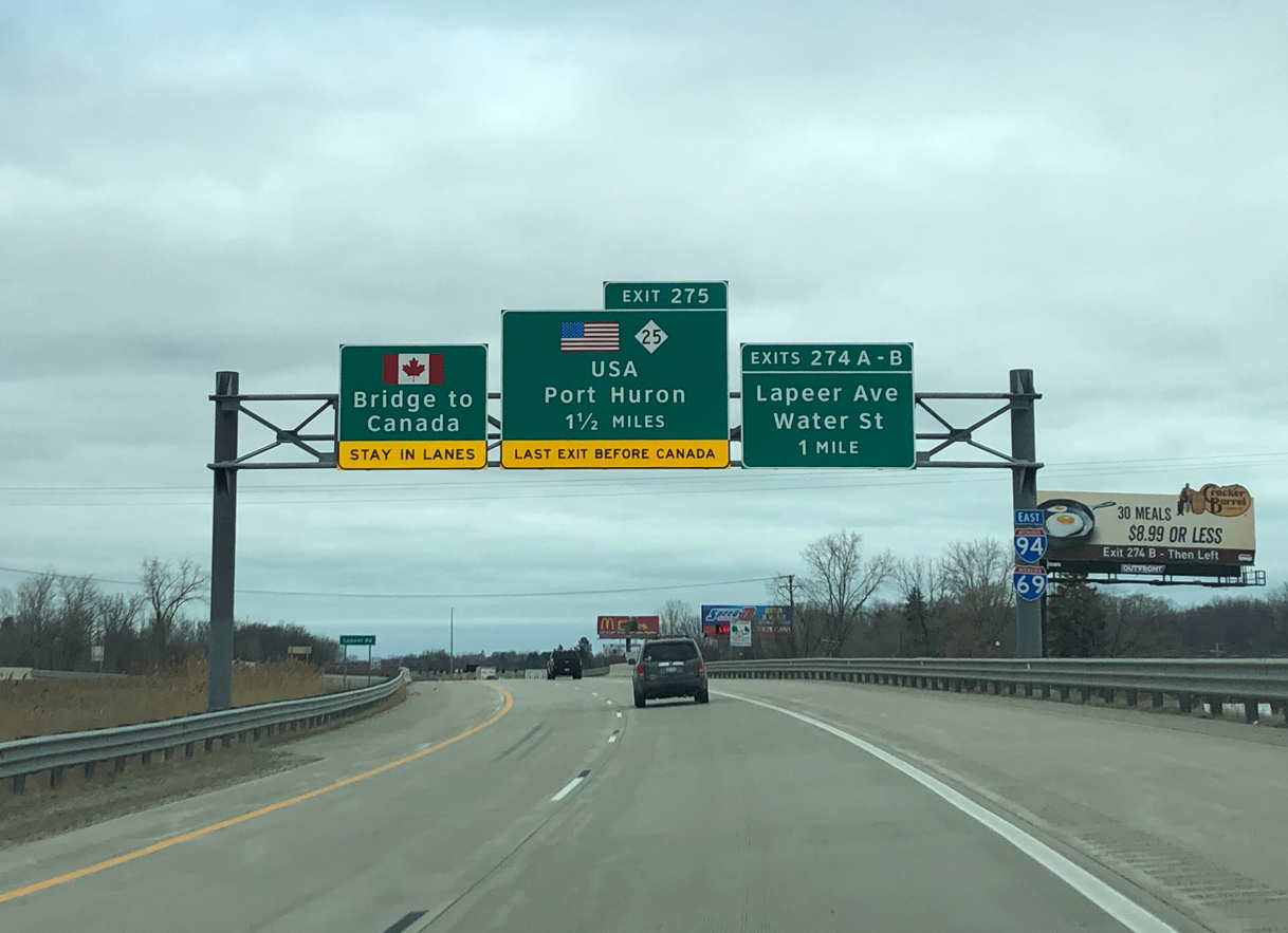
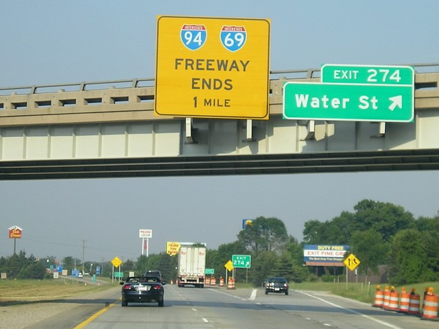
Turning north from Business Loop I-69, I-69/I-94 cross Lapeer Avenue northeast one mile to a distributor roadway (Exit 274) for the Lapeer Connector and Water Street. Photo by Peter Johnson (03/14/20).
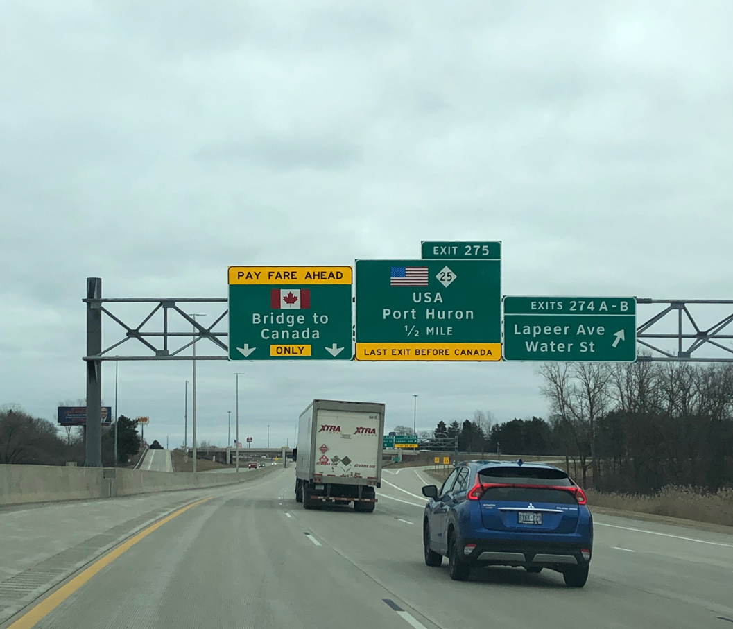
Major reconstruction underway along I-94/69 in 2011 reconfigured the wye interchange with the Lapeer Connector into a split diamond interchange with adjacent Water Street to provide eastbound access. The connector is a controlled access link between Business Loop I-69 (Lapeer Avenue) and I-94/69. Photo by Peter Johnson (03/14/20).
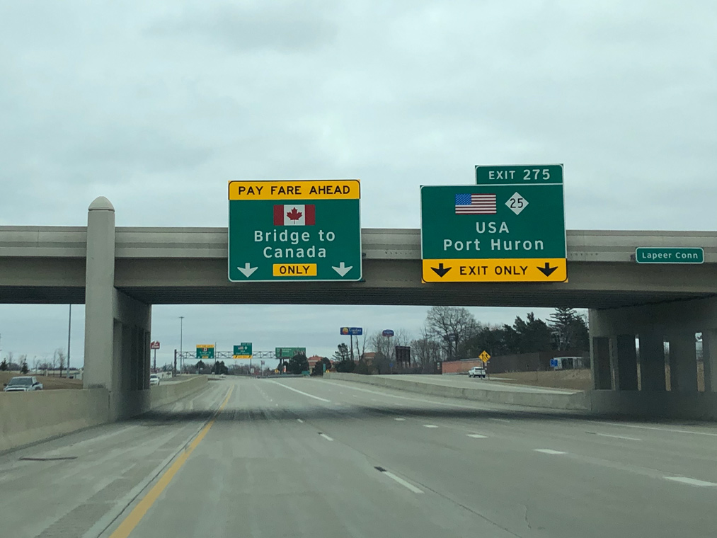
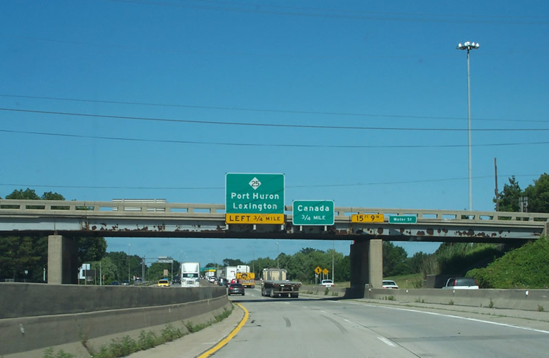
I-94/69 advance east from the Lapeer Connector and Water Street to the separation with Exit 275 for M-25 (Pine Grove Avenue) and the Bluewater Bridge approach into Canada. Photo by Peter Johnson (03/14/20).
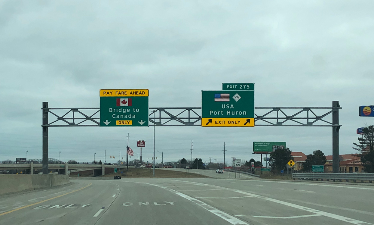
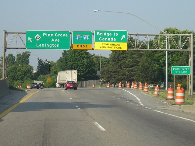
Crossing the Black River, Exit 275 partitions from I-94/69 eastbound for M-25 (Pine Grove Avenue) and Business Loop I-69/94 to the northwest of Downtown Port Huron. Two lanes continue onto the tolled Bluewater Bridge spanning the St. Clair River. Photo by Peter Johnson (03/14/20).
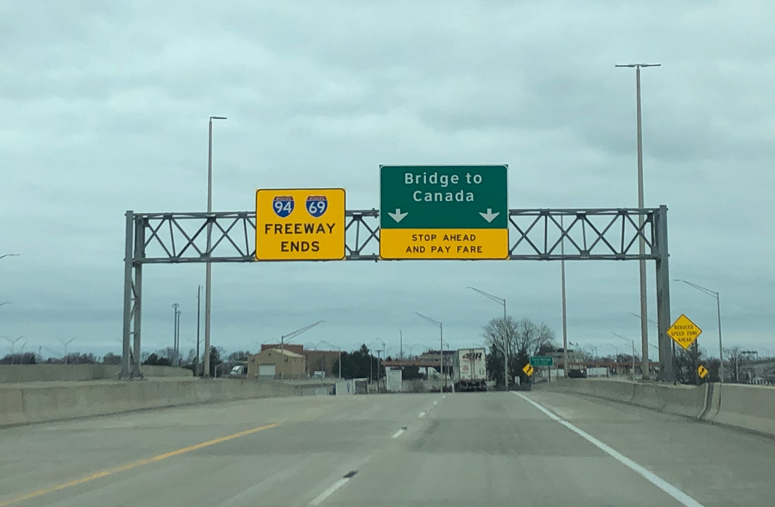
A freeway ends sign precedes the Bluewater Bridge toll plaza, which lies between M-25 and 10th Avenue. Photo by Peter Johnson (03/14/20).
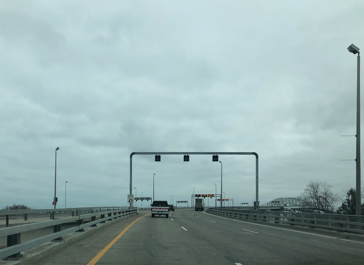
Ascending onto the Blue Water Bridge from the end of I-69/94 eastbound. There are no other crossings of the Great Lakes between Port Huron and the Mackinac Bridge (I-75) linking Mackinaw City with St. Ignace. Photo by Peter Johnson (03/14/20).
![]() West at Bluewater Bridge
West at Bluewater Bridge
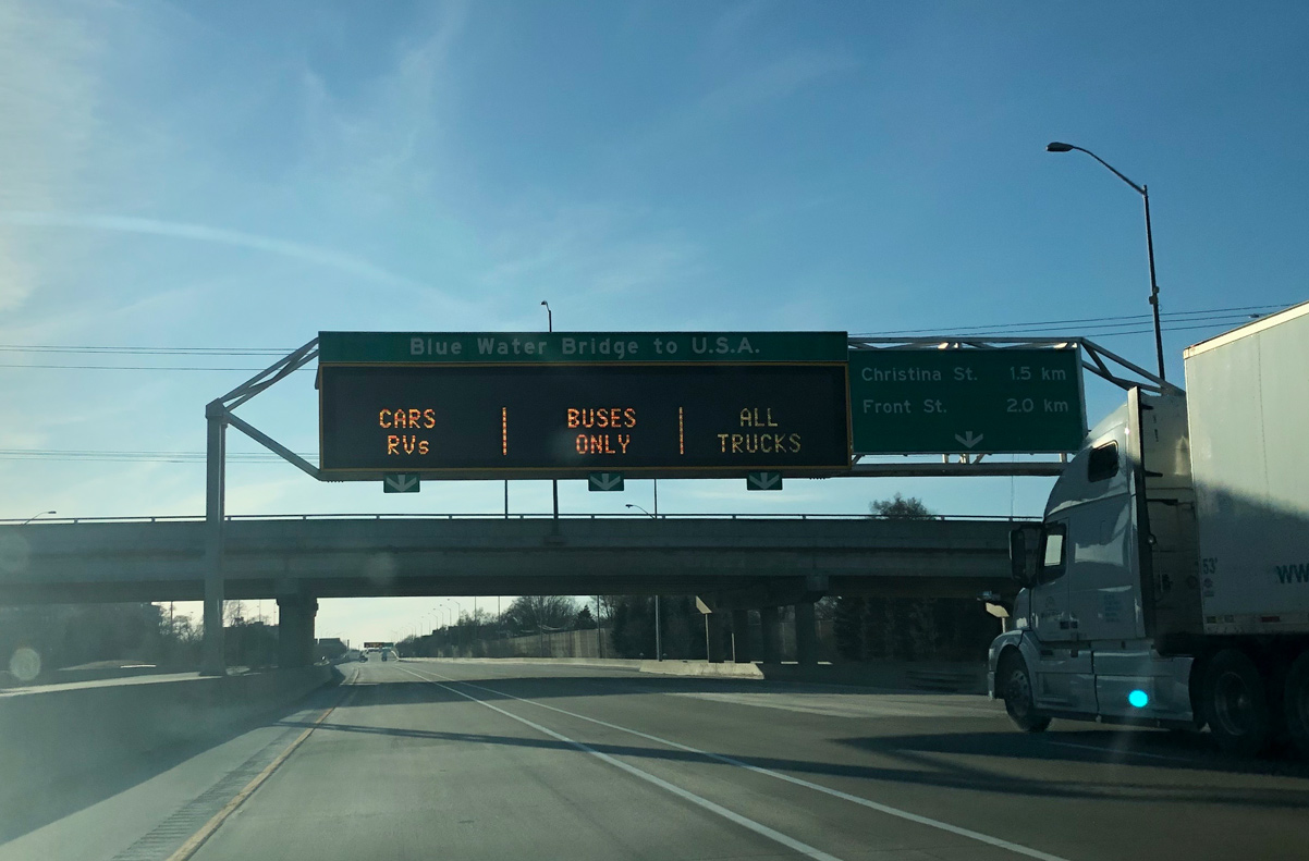
Highway 402 advances two miles west from the parclo interchange with Indian Road to the Bluewater Bridge toll plaza in Sarnia. Photo by Peter Johnson (03/15/20).
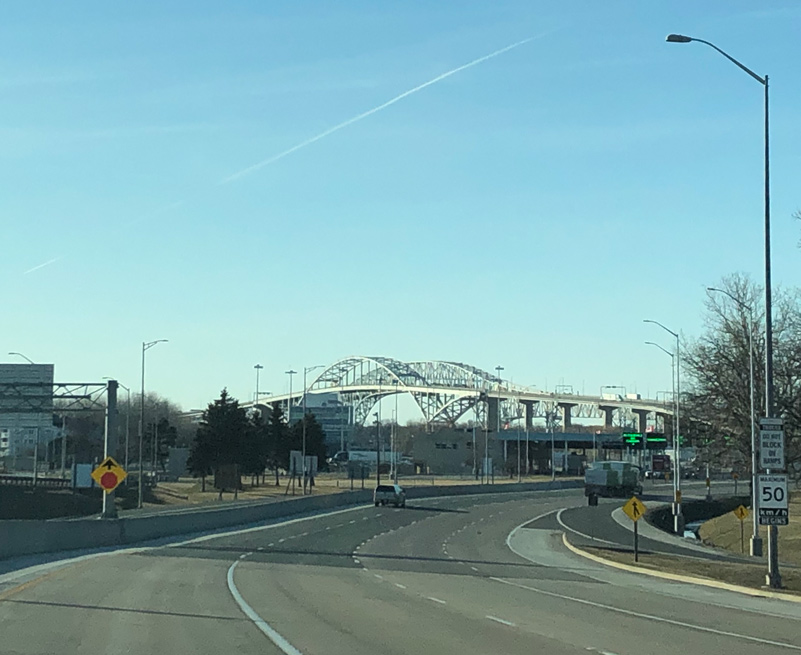
Highway 402 shifts northwest from Front Street to the Bluewater Bridge crossing the St. Clair River west to I-69/94 in Port Huron, Michigan. Photo by Peter Johnson (03/15/20).
 East End Throwback
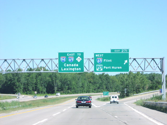
Eastbound Interstate 94 at I-69 west and Business Loop I-69 east in Port Huron. I-69 and I-94 combine for the final distance toward the Blue Water Bridge. Photo taken by Jim Teresco and Rob Foulis (06/27/01).
I-69/94 combine east ahead of Water Street and the freeway conclusion at M-25 and the Blue Water Bridge into Canada. Major reconstruction was underway along I-69/94 in 2011 between Exit 274 and the Blue Water Bridge approach. Photo by Jeff Morrison (07/01/07).
Construction in 2011-12 reconfigured the wye interchange joining I-69/94 east with M-25 (Pine Grove Avenue) to eliminate the left exit ramp. Photo by R. Bruce Telfeyan (07/24/04).
Changes made at the east end of I-94/69 in 2011-12 shifted the mainline approach for the Bluewater Bridge to the left and added a new ramp for M-25 to replace the previously unnumbered ramp from the left. Photo by Jeff Morrison (06/25/07)
West End  – Billings, Montana
![]() West at
West at ![]()
![]()
![]()
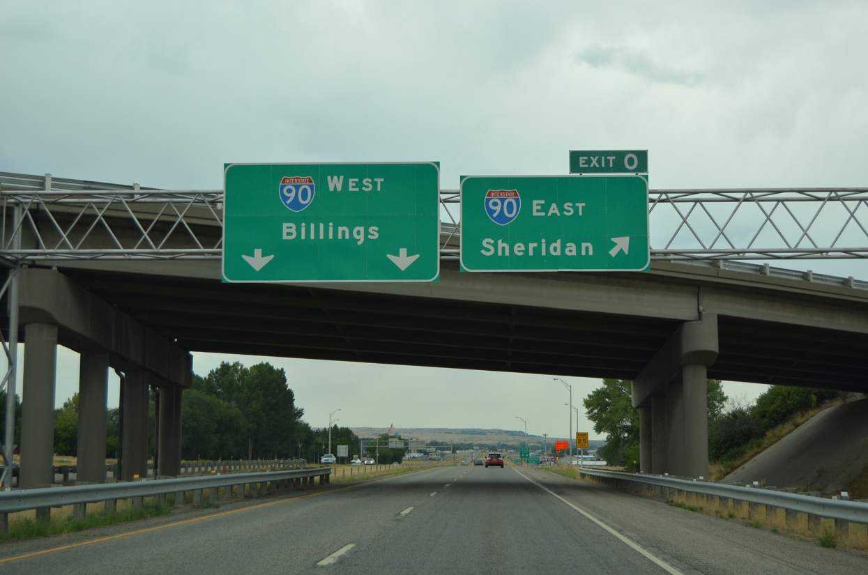
Interstate 94 west lowers two miles from the hills east of Billings to end at I-90/U.S. 87-212. 08/07/16
Spanning Coulson Road, one mile ahead of the trumpet interchange (Exit 0) with Interstate 90. 08/07/16
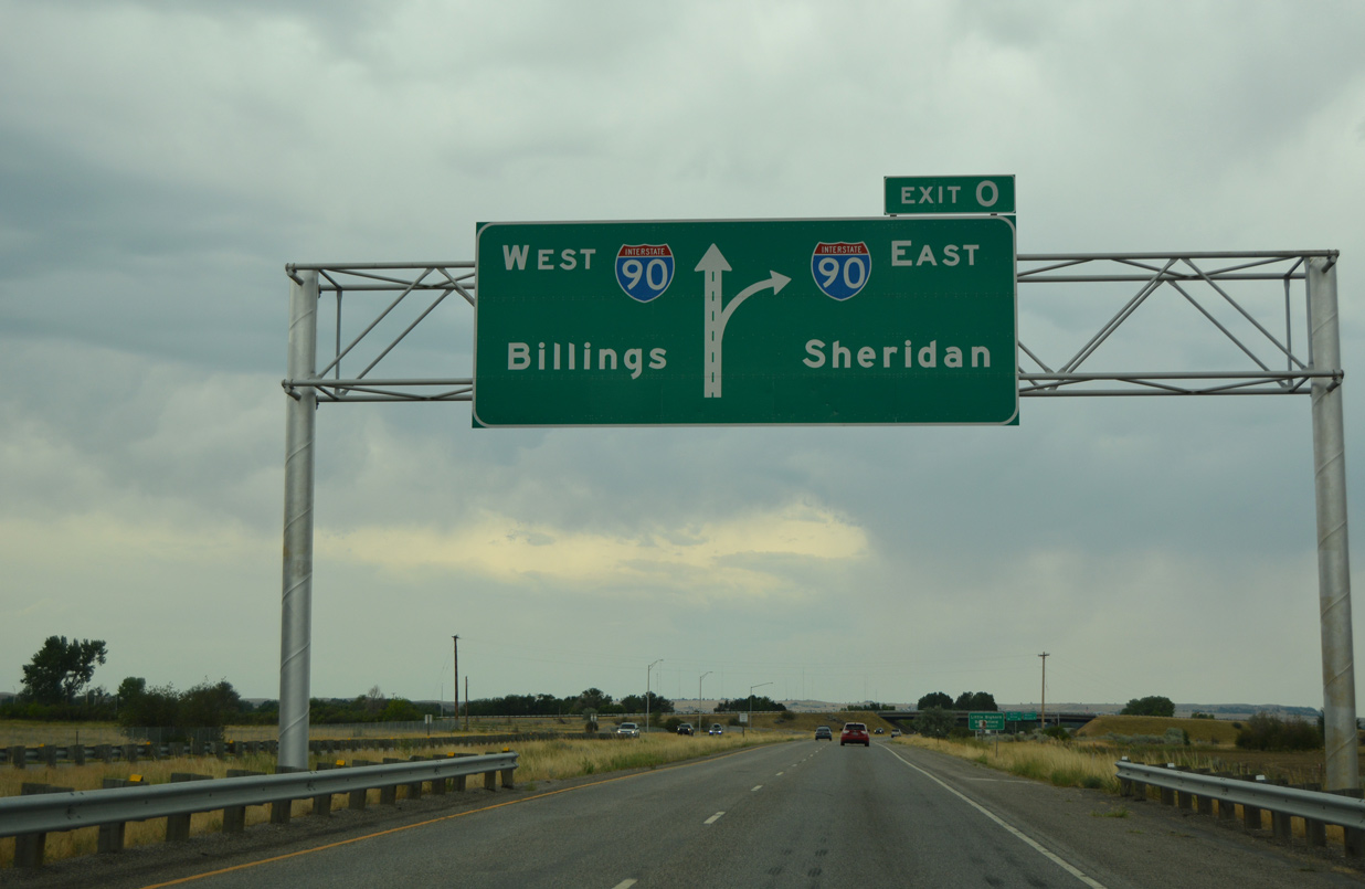
The westbound mainline of Interstate 94 defaults onto I-90/U.S. 87-212 into the city of Billings. The freeway passes just south of Downtown, with a business route looping into the city center. 08/07/16
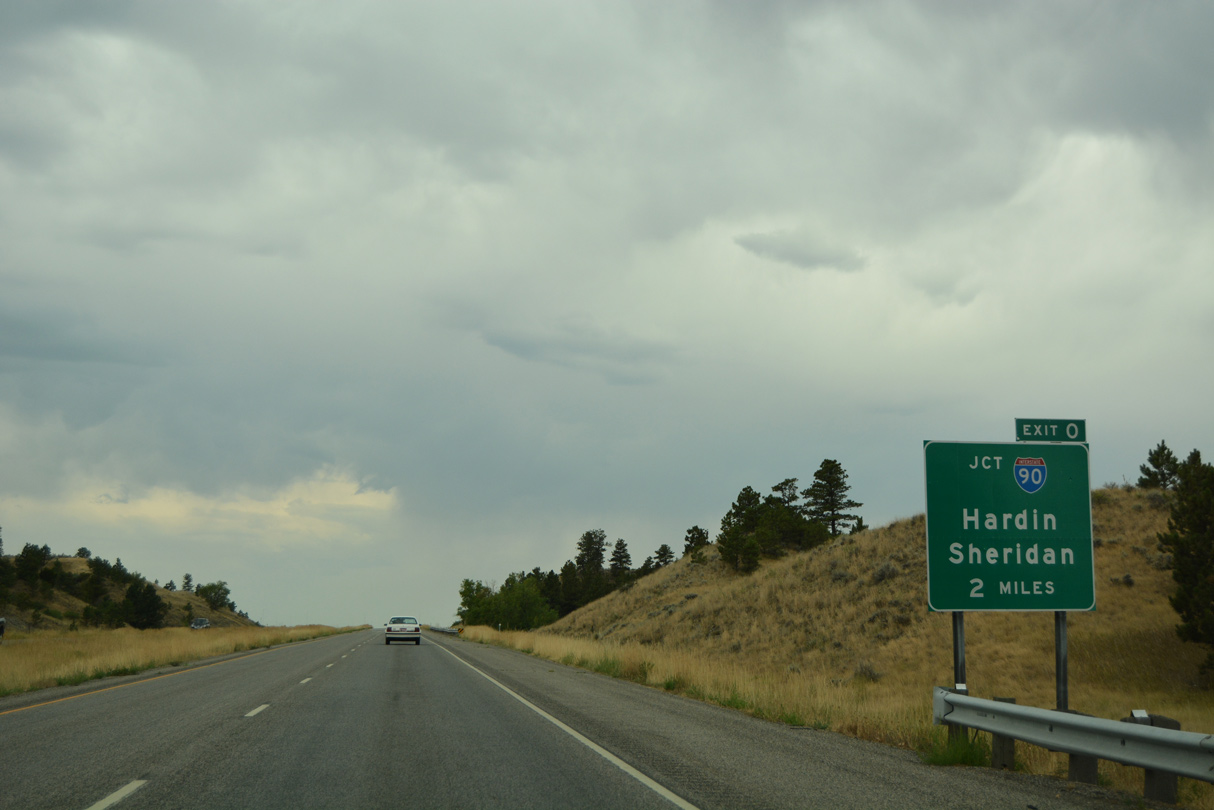
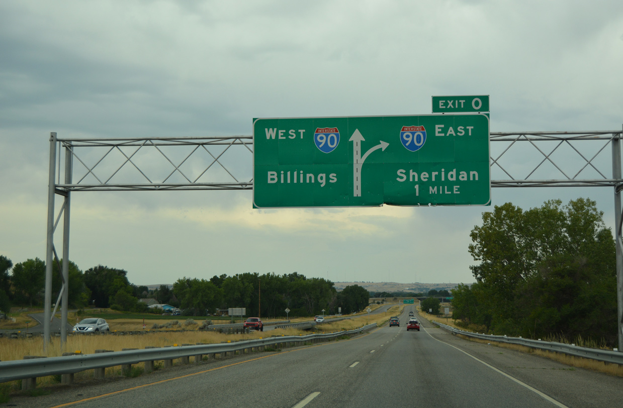
Exit 0 loops away from I-94 west to I-90 and U.S. 212 east / U.S. 87 south to Hardin and Sheridan, Wyoming. Outside of a 16 mile section through Sheridan, U.S. 87 remains concurrent with I-90 to Interstate 25 at Buffalo, Wyoming. 08/07/16
![]()
![]() East
East ![]() South at
South at ![]()
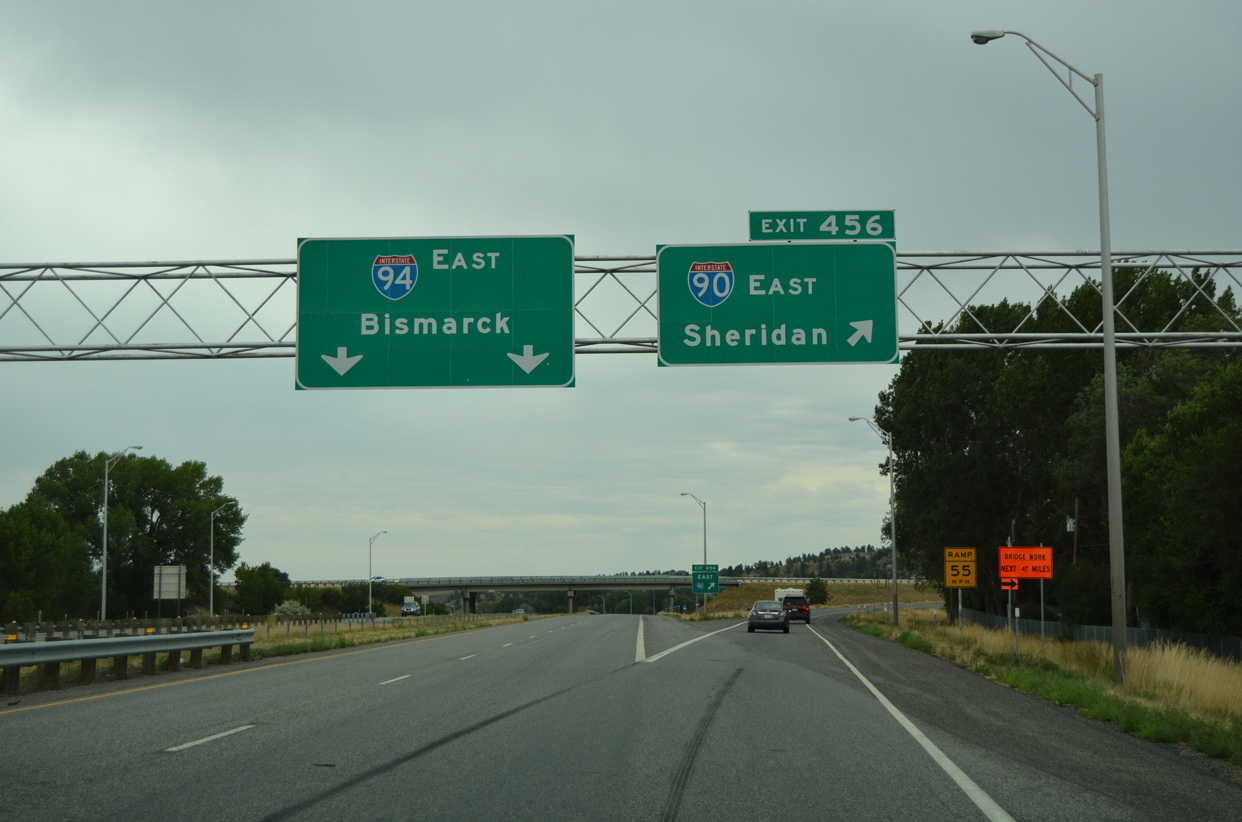
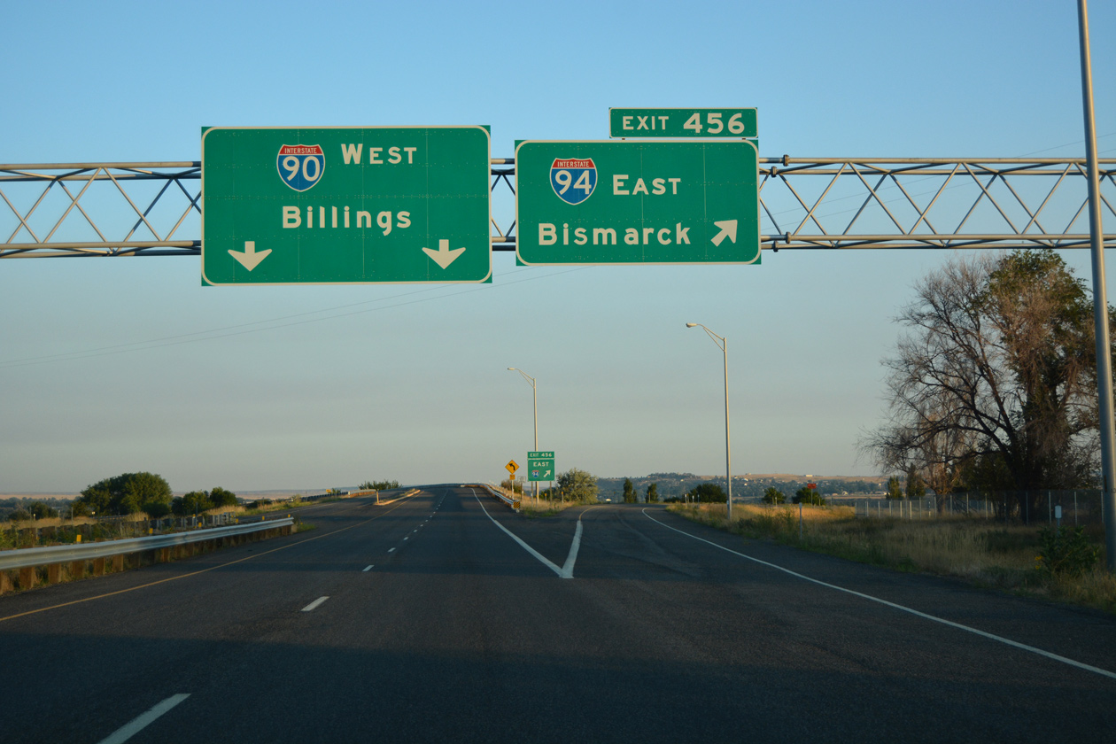
I-90/U.S. 87-212 runs northeast through industrial areas of Lockwood to the split with Interstate 94 (Exit 456). 08/07/16
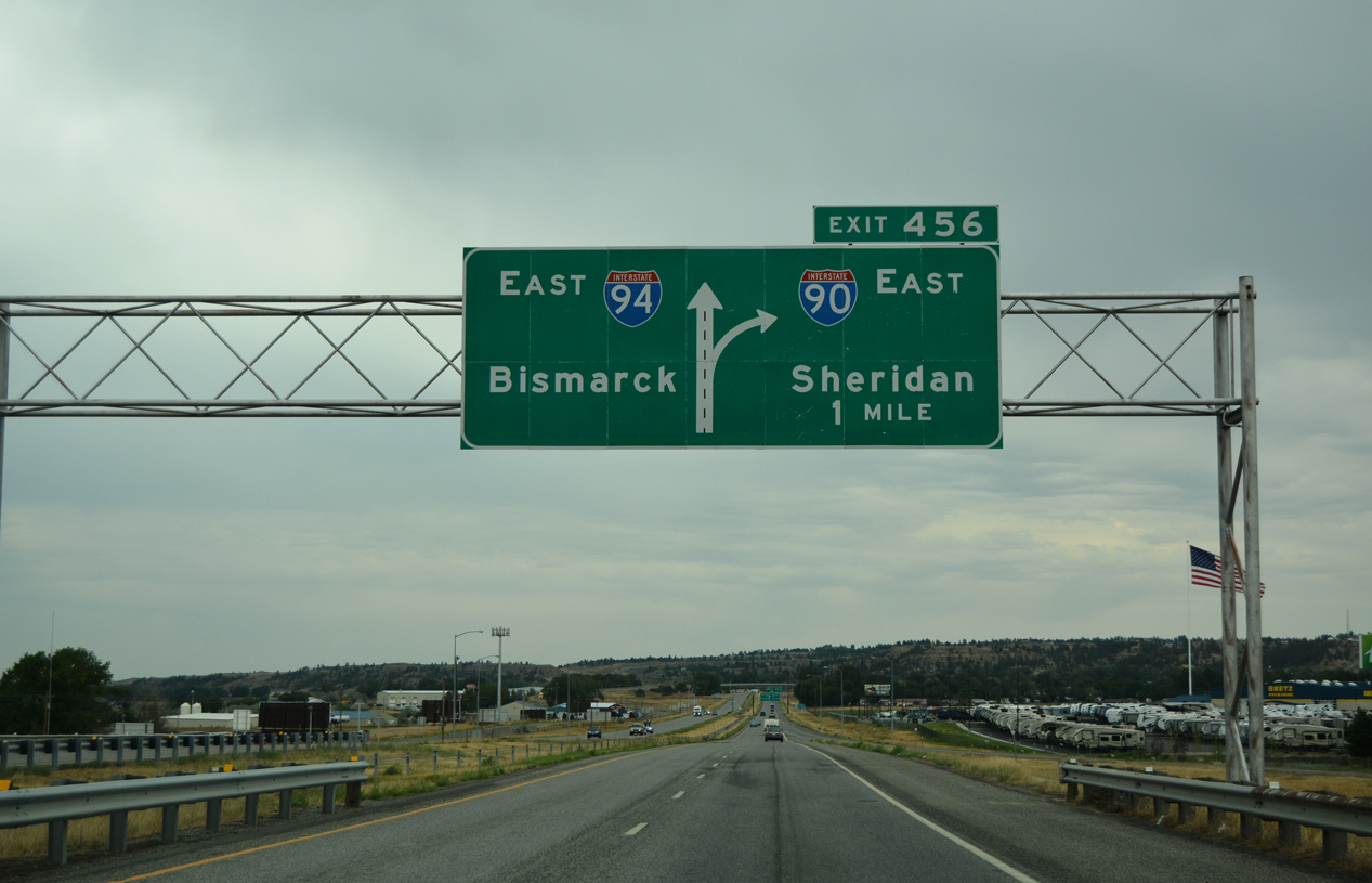
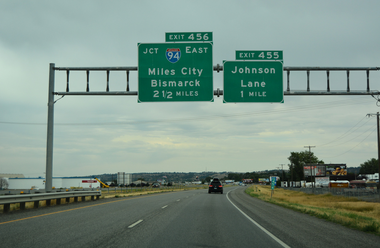
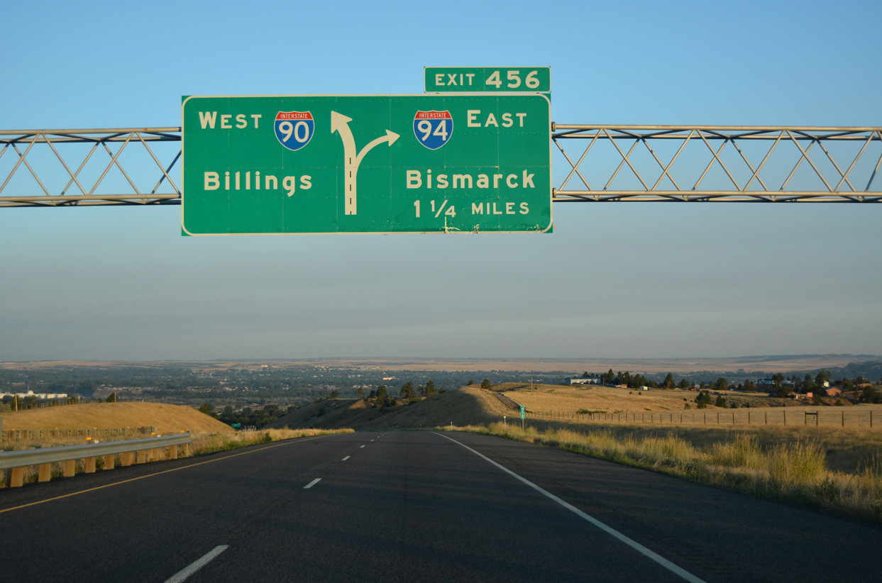
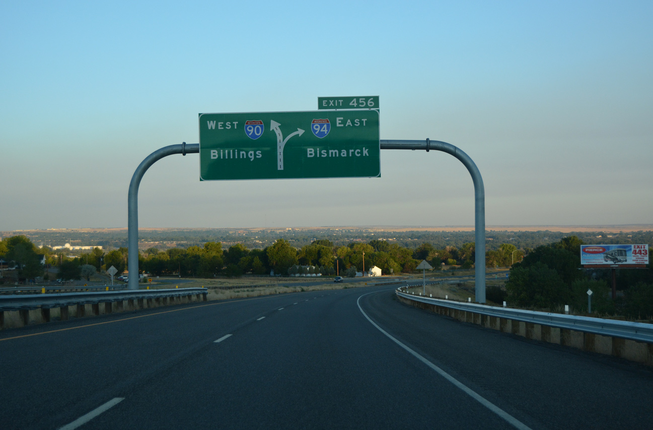
Advancing beyond the Johnson Lane exit, a diagrammatic sign outlines the TOTSO continuation of Interstate 90 east at Exit 456. 08/07/16
I-90 and U.S. 87-212 turn east at the forthcoming split to traverse Pine Ridge from I-94 to Hardin while I-94 parallels the Yellowstone River northeast to Miles City and Glendive. 08/08/16
Interstate 94 commences a 410 mile long course to Bismarck as the through route from I-90 east at Exit 456. The next major population center along I-94 is Miles City, located 138 miles away. 08/07/16
![]()
![]() West
West ![]() North at
North at ![]()
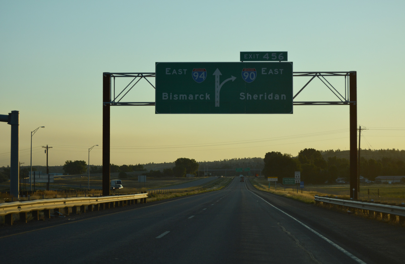
I-90/U.S. 87-212 traverses a ridge line east of Billings ahead of Exit 456 with I-94. The initial guide sign is the lone reference for Miles City. 08/08/16
The broad Yellowstone River valley comes into view as I-90 lowers toward the trumpet interchange (Exit 456) with Interstate 94 east. 08/08/16
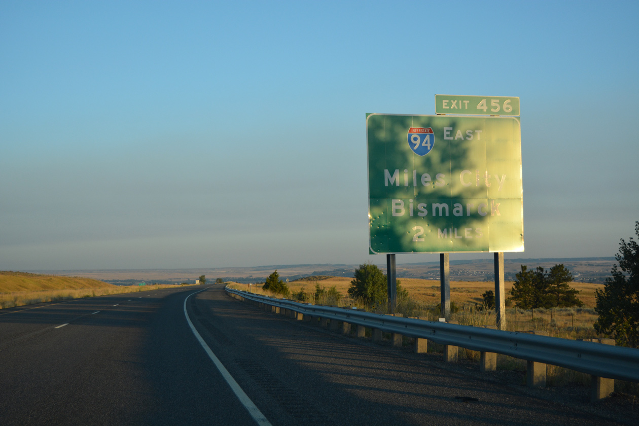
A 5.2 mile exit less stretch along I-90-U.S. 212 west / U.S. 87 north concludes at the west end of Interstate 94. I-94 enters Billings from Huntley, six miles to the northeast. 08/08/16
Interstate 90 west overtakes the ending I-94 at Exit 456, four miles east of the Billings city limits. This is not the only time I-90 and I-94 meet. They previously overlapped between Madison and Tomah in Wisconsin and from Lake Station, Indiana to Chicago, Illinois. 08/08/16
Sources:
- Three Digit Interstates: Interstate 894 (Scott Oglesby/Kurumi.com)
- Marquette Interchange
http://www.mchange.org/– official site. - Lokken, Chris. Personal Email, “Some Information on Wisconsin Interstates,” April 7, 2006.
- “I-94/I-69 reopens near the Blue Water Bridge in Port Huron.” MDOT press release, October 19, 2012.
- Dan Ryan Expressway Reconstruction
http://www.danryanexpressway.com– official site - “Governor Blagojevich announces completion of Dan Ryan reconstruction – A safe and wider Dan Ryan Expressway; IDOT to open up all lanes to traffic ahead of schedule.” Office of the Governor, press release, October 25, 2007.
- Kingery Expressway Reconstruction
http://www.kingeryexpressway.com/– official site - “After seven years Borman Expressway backups in rear view mirror.” Indiana Economic Digest, August 19, 2011.
- Celebrating the 50th Anniversary of the Eisenhower Interstate Highway System: Previous Interstate Facts of the Day by the Federal Highway Administration (FHWA).
- “Sprynczynatyk Attends Kick-Off Celebration for 50th Anniversary of the Interstate Highway System,” January 23, 2006, North Dakota DOT Communications
- Encyclopedia of Chicago: Expressways by Dennis McClendon of the Chicago Historical Society
- Chicago Timeline: 1960 Northwest Expressway Completed; November 29, 1963 Renamed The John F. Kennedy Expressway
http://www.chipublib.org/004chicago/timeline/kennedyx.html, Chicago Public Library, updated August 1997 - Chicago Timeline: 1962 Dan Ryan Expressway Opened
http://www.chipublib.org/004chicago/timeline/danryanx.html, Chicago Public Library, updated March 2006 - Encyclopedia of Chicago: Tollways
http://www.encyclopedia.chicagohistory.org/pages/1257.html, by David M. Young of the Chicago Historical Society - “Lanes of I-94 reopen at I-69 interchange.” The Times Herlald, December 19, 2014.
- North Dakota Highways Page: Highways 61 to 100,
http://www.northernplainshighways.org/ndakota/nd61-100.htmlChris Geelhart. - Michigan Highways: Highways 90 through 99. Chris Bessert.
- “In Duluth , the end of the road – Final part of I-35 will be opened on Wednesday” Star Tribune: Newspaper of the Twin Cities, October 25, 1992.
- “Montana Road Construction Contracts Are Awarded.” The Spokesman-Review, April 20, 1961.
- “I-90 now four lanes all across Montana.” The Spokesman-Review, May 14, 1987.
- “Residents Laud Change To 4-Lane On Local Stretch.” The Billings County Pioneer, May 14, 1965.
- “Interstate changed way North Dakotans lived.” Bismarck Tribune, The (ND), June 24, 1996.
- “I-94 Opens Between Mandan and Bismarck, 1965.” Bismarck Tribune, The (ND), December 11, 2015.
- “Dedication Ceremony Set for Interstate 94.” Steele County Press (Finley, ND), August 3, 1961.
Page updated November 13, 2020.