

Since the early 2000s, Interstate Guide has documented America's Interstate Highway System through photography, route histories, business routes, and reference material. The site covers both the familiar and overlooked parts of the national network.
Browse Interstate highways by route number or state, explore historical features and trivia, follow proposed corridors, and discover the stories behind the roads that connect the country.
Explore Interstate Guide
Browse Interstate routes, discover business loops, explore historical features, and follow the continuing evolution of America's highway network.
✓ Mainline Interstates
✓ Auxiliary Routes
✓ Future Interstates
✓ Former Routes
✓ Unsigned Routes
✓ Business Routes
 Browse by Route Number
Interstate families and branch routes.
Browse by Route Number
Interstate families and branch routes.
 Browse by State
Routes organized geographically.
Browse by State
Routes organized geographically.
 Business Routes
Former alignments and downtown connectors.
Business Routes
Former alignments and downtown connectors.
 Features
History, trivia and numbering guides.
Features
History, trivia and numbering guides.
 What's New
Recent additions and updates.
What's New
Recent additions and updates.
 About Interstate Guide
Contributors and project history.
About Interstate Guide
Contributors and project history.

The Interstate Highway System has evolved substantially since the early years of completion. Today the system continues to grow with new corridors developed with Congressional authority, such as I-69 between Texas and Indiana, the completion of I-49 in Arkansas and Louisiana and the southern extension of I-27 from Lubbock to Laredo, Texas. Interstate Guide documents both the original network and the routes added through decades of expansion.
Interstate Guide currently documents:
 Interstate Numbering Guide
Numbering guidelines for the Eisenhower Interstate System. Why is there an I-238 but no I-38? Read More →
Interstate Numbering Guide
Numbering guidelines for the Eisenhower Interstate System. Why is there an I-238 but no I-38? Read More →
 Proposals and Unbuilt Routes
Previously proposed or suggested long distance and regional Interstate corridors that were never realized or otherwise remain unconstructed. Read More →
Proposals and Unbuilt Routes
Previously proposed or suggested long distance and regional Interstate corridors that were never realized or otherwise remain unconstructed. Read More →

Recent Updates
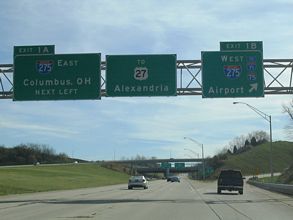

Updated coverage of the north end in Cincinnati, Ohio and the south end of I-471 at Highland Heights, Kentucky with photos from August 15, 2024. Also added scan of a 1965 map of Cincinnati.
2026-08-31 16:19:55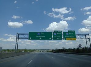

Replaced four photos at the northern junction with I-75 in Ohio and three at the south junction in Kentucky with photos from 08/15/24. Added a scan of a 1968 map of Cincinnati.
2026-08-31 15:08:13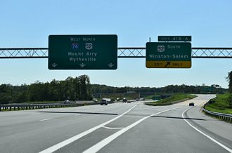

The final section of Interstate 74 along the Winston-Salem Beltway is scheduled to open to traffic on September 19, 2026. A ribbon cutting ceremony for the last segment, between I-74/NC 192 and I-40 in southeastern Winston-Salem, took place on August 28, 2026.
2026-08-31 12:32:12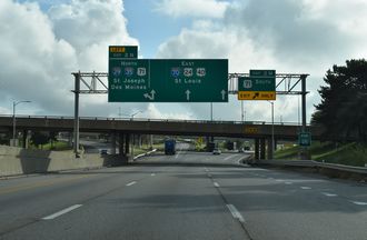

Added three photos covering I-670 east at I-70 and U.S. 24/40/71 in Kansas City, Missouri from July 13, 2026.
2026-08-28 16:20:24